One of our employees has put together a three-hour walk for you with the most beautiful spots of our city. If you feel like discovering Luxembourg City in a short time, you can follow this trail. Make sure you wear good shoes. Have fun!
In this map are listed our highlights:
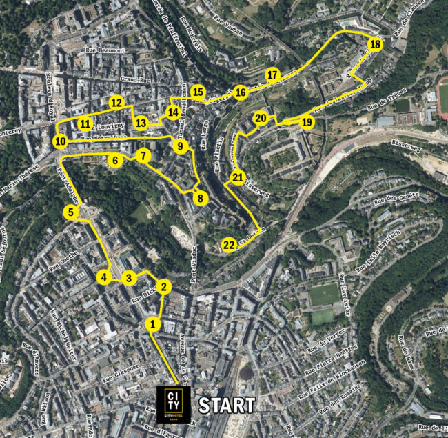
© Geoportail.lu
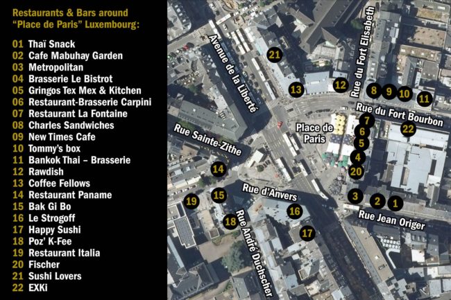
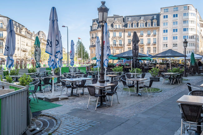
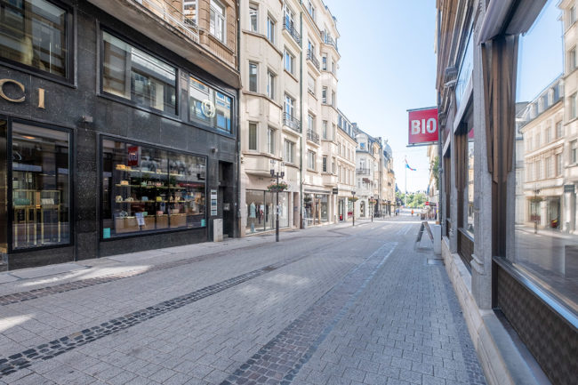
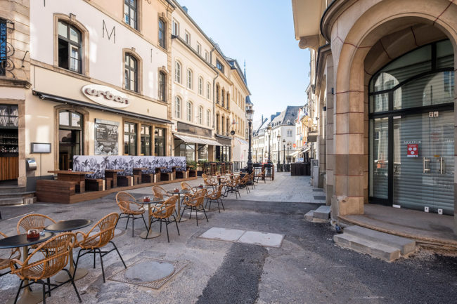
#1 – Place de Paris
More than 50 years ago the first hamburger fast food chain “Wimpy” opened on the Place de Paris. Today you can find many bars and restaurants here within only five-minutes walking distance from City Hotel. Our personal selection could be found on this map.
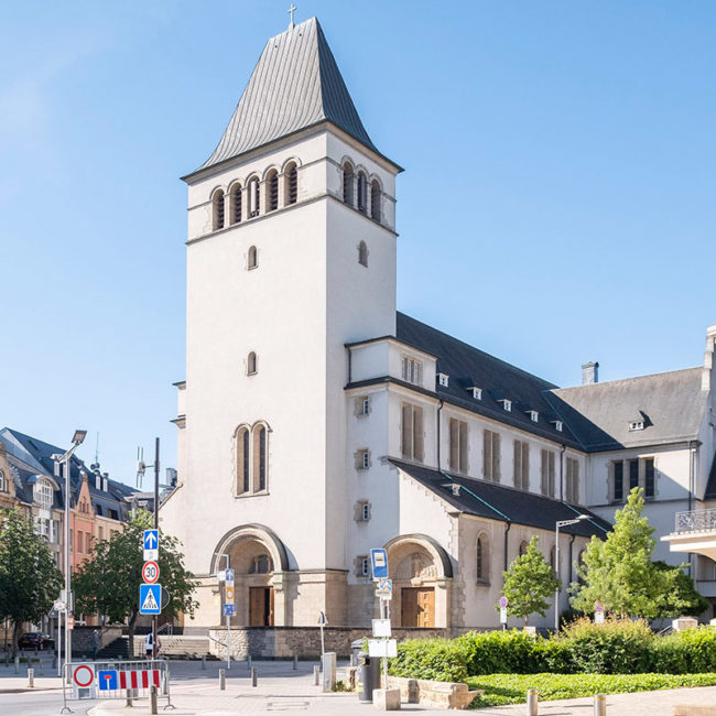
#2 – Sacré Coeur / Sacred Heart Church
The Sacred Heart Church was built in 1930 by Luxembourg architect Nicolas Petit. Only a six-minutes walk from the City Hotel to the “rue du Fort Elisabeth” you can admire this neo-romantic modern building whose design is as a model for many other churches throughout the country.
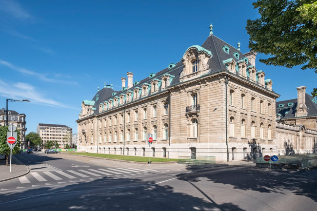
#3 – ARBED-Building
The ARBED building (ARBED was a big Luxembourgish steel company) has been designed by French architect René Théry and was built in 1922. It was the former headquarters of Arcelor-Mittal. Today the refurbished historical building is listed as a national monument and is occupied by the Spuerkeess (State Bank).
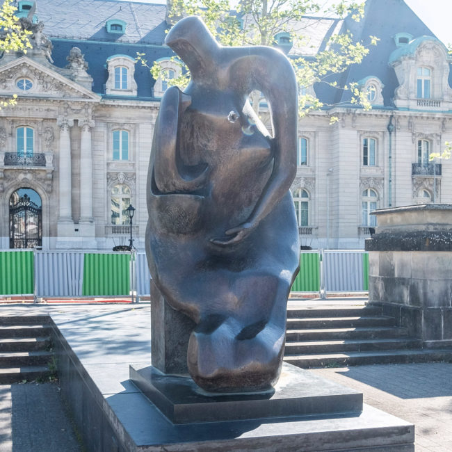
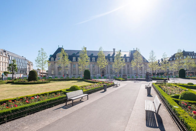
#4 – Rousegäertchen / Place des Martyrs
The Rousegäertchen (English: garden of roses) is a beautiful park located among the main street “avenue de la liberté”. It was laid out in the 1920s. Three paths converge towards the former ARBED building where the bronze sculpture “Mother and Child” by British artist Henry Moore is located.
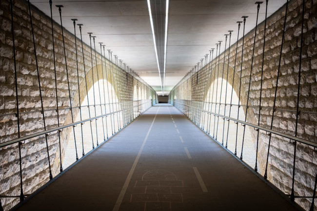
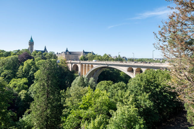
#5 – Pont Adolphe
If you continue to walk up the “avenue de la liberté” from “Rousegäertchen”, you reach the Adolphe Bridge, also called “Nei Bréck”, which connects the old town with the railway station district. The bridge was opened in 1903. It is 153 m long and 42 m high and is characterized by its large arch. Between 2014 and 2017, the bridge has been renovated with an innovation: a bicycle and pedestrian bridge that hangs under the bridge between the arches on steel cables (see photo). Left to the bridge a path leads down. There are even five copies (sibling bridges) of the Adolphe bridge with the same design: in Philadelphia, in Castilla-La Mancha, two in Occitania and one in Algeria.
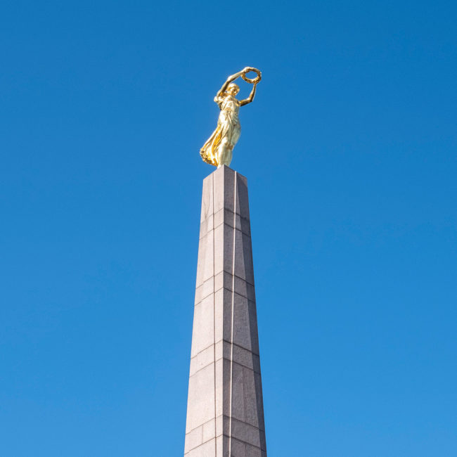
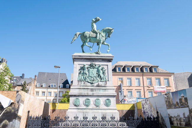
#6 – Gëlle Fra / Place de la Constitution
After the Adolphe bridge, turn right. The “Gëlle Fra” (English: Golden Woman) is the common name of this national monument (design name: Queen of Peace) which has a strong symbolism for many people. It is a gilded female figure created by the sculptor Claus Cito. The monument commemorates the Luxembourg volunteers who died in the Foreign Legion on the French side during the First World War. Today it is a general monument against the Nazi dictatorship and commemorates the victims of the war. The woman who is supposed to represent the Greek goddess “Nike” holds a laurel wreath in front of her with outstretched arms.
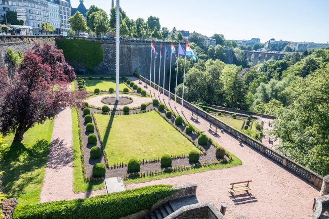
The ”Place de la Constitution” is also one of the most breath-taking viewpoints in the city. One “floor” below are the beautifully landscaped gardens, surrounded by the high stone walls of the medieval fortress ruins.
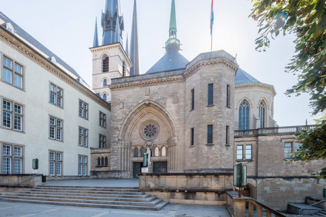
#7 – Notre-Dame Cathedral
Opposite the “Gëlle Fra” you can see the Roman Catholic Cathedral, also called “Mariendom”. It was built by the Jesuits between 1613 and 1621 and the crypt is the resting place of John the Blind, King of Bohemia and Count of Luxembourg. On Good Friday, 6th April 1985, one of the three towers caught fire and the church bells were destroyed.
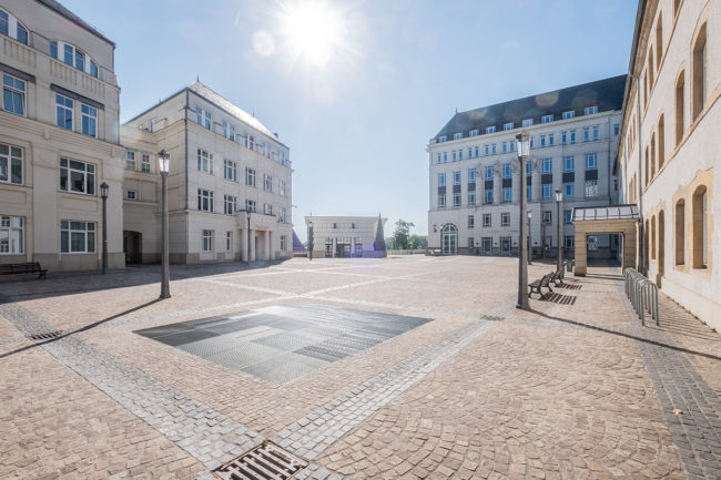
#8 – Cité Judiciaire
Our next stop is the “Cité judiciaire”. It is an architectural ensemble of several buildings located on the Saint-Esprit plateau (Holy Ghost). The buildings accommodate the judicial administration of Luxembourg City. In the smaller building in the middle of the photo you can find an elevator that connects the upper city with the “Grund”. You would then immediately come to our station #21. We continue on foot up the small quirky alley “Rue du St Esprit”.
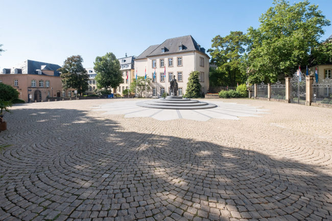
#9 – Place Clairefontaine
The Clairefontaine Square became a pedestrian zone in the 80s. The square is famous for the monument of the Grand Duchess Charlotte that has been installed in 1990, a sculpture by Jean Cardot. Charlotte reigned as Grand Duchess of Luxembourg from 1919 until her abdication in 1964. During the German occupation of Luxembourg in World War II she became an important symbol of national unity. The name Clairefontaine comes from the refuge of the former abbey Clairefontaine which was demolished in 1933.
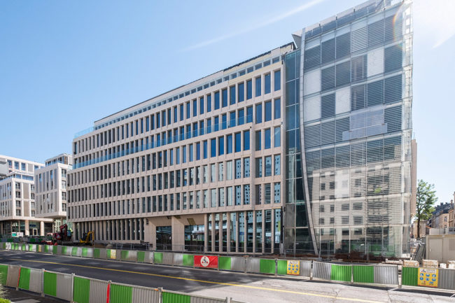
#10 – Royal Hamilius
At the end of the Clairefontaine Square, we turn left into “Rue Notre-Dame” and walk along the street until the very end and turn right. In the past there was the post office, a big bus station and in the 80s, a hip-hop scene with break-dancers established itself in the underpasses. Major reconstruction works started in 2015 and since 2019 modern new buildings have been constructed here under the name “Royal Hamilius” with shops, office space, supermarket, apartments and restaurants.
#11 – Rue Philippe II
By passing the Royal Hamilius and walking alongside the Avenue Monterey we encounter the most expensive shopping street of Luxembourg with its posh boutiques. For more information about shopping in Luxembourg you can visit the website of “Cityshopping Luxembourg”.
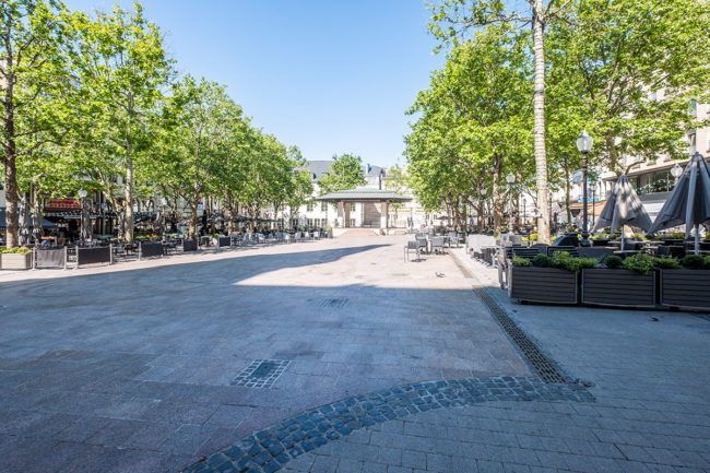
#12 – Place d’Armes
Continuing straight ahead, you will come across a central meeting point of the city, the “Place d’Armes” (literally: Arms Square) with the imposing “Cercle Cité” building, an administrative building with several ballrooms. You’re right here if you’re looking to sit on a nice terrace and watch the hustle and bustle of the city. Markets and events as well as concerts often take place here.
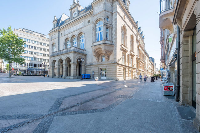
#13 – Knuedler / Place Guillaume II
If you walk up the alley to the right of the “Cercle Cité” (photo), you will find a passage on your right to another large meeting place of the city, called the “Knuedler” (French: Place Guillaume II, named after William II, King of the Netherlands and Grand Duke of Luxembourg). In the middle of the 13th century, the church and monastery of the Franciscan Order were located here. The knot of the belt of the monks is called “Knued” in Luxembourgish, hence the name of the square. Today, the Luxembourg City Tourist Office and the Luxembourg City Hall are located here. Every Wednesday and Saturday there is a local market and events are often held on this square.
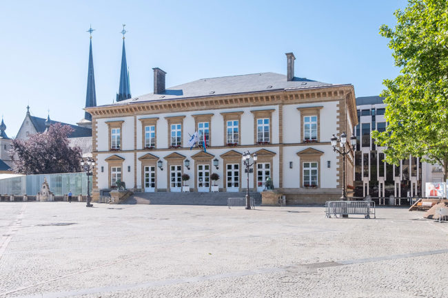
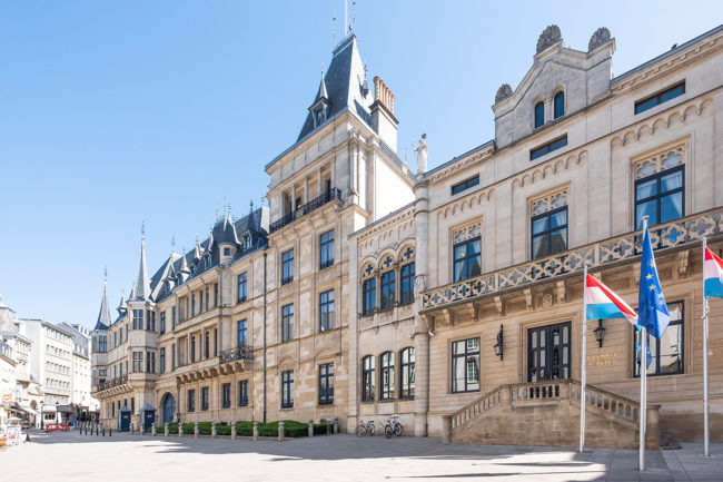
#14 – Palais / Grand Ducal Palace
At the end of the “Knuedler”, following the “Rue de la Reine”, you can immediately see a part of the “Palais”, the grand ducal palace at the so-called “Krautmaart” (English: Herbs Market). The palace is the official residence of the Grand Duke and is mainly used for official events and foreign heads of state are received here. The “Chambre des Députés”, next to the palace is the unicameral national legislature of Luxembourg which meets at “Hôtel de la Chambre”. In the streets around the palace there are many good cafés and restaurants and on weekends there is a lively nightlife.
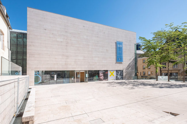
#15 – National Museum of History and Art / Fishmarket
To the left of the palace up the street past the cafés and then directly to the right down to the so-called “Fëschmaart” (English: fishmarket) you can see the National Museum of History and Art (MNHA). The museum has 5 underground floors. The rock under the fishmarket has been hollowed out for this purpose. The concept of the museum is to reconstruct the chronology of history and art from bottom to top – from the 5th basement floor where you can find the pre- and early history, up to the 4th floor that hosts modern paintings.
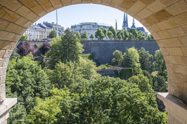
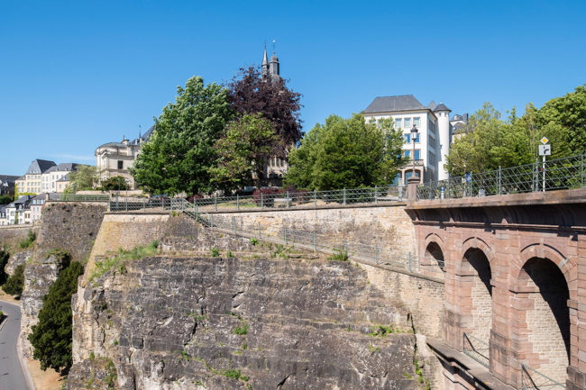
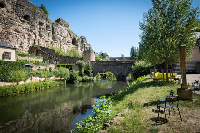
#16 – Bockfiels
If you pass the fishmarket and the museum down the street, you get to a very popular viewpoint, the “Bockfiels” (bock rock). It is 500 m long and 50 to 80 m wide and is surrounded by the “Uelzechtdall” (Alzette valley) which is 40 m lower. The view down to the Neumünster Abbey (also see station 20) is a very popular photo motif. Here you definitely have the best panoramic view of the old fortress town. Beautiful view of the old castle bridge as well as the partly reconstructed castle or the so-called “Kasematten”, the old underground passages that go down up to 40 m deep into the stone and are up to 23 km long.
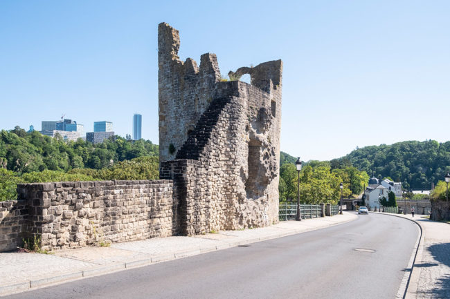
#17 – Huelen Zant
A little further down the road on the left side you will see the ruins of a tower on the “Bockfiels”, called “Huelen Zant” (English: Hollow Tooth). It actually looks like a tooth. It is the former left tower of the gate of the fortress. It was rebuilt in 1874 as a pseudo-ruin because it was considered romantic.
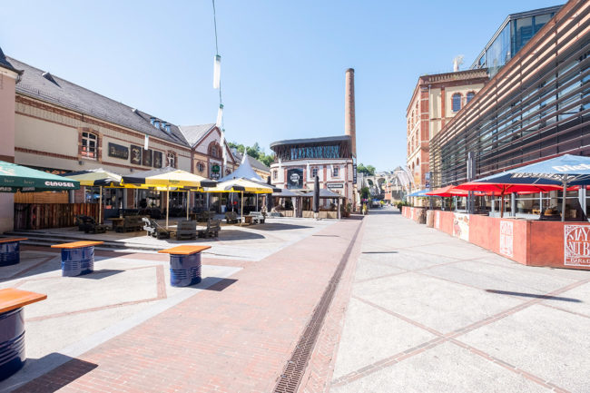
#18 – Rives de Clausen
We follow the road down the “Huelen Zant” until we reach the district Clausen. At the bottom we turn right into the “Rives de Clausen”. This is a vibrant district with hip bars and restaurants. In former times the seat of the Mousel beer brewery was located here.
#19 – Rham Plateau
At the end of the amusement area, there is a bridge over the Alzette on the left. On the right side we go quite steeply uphill. At the top we go left 180 degrees around the loop and a little bit further up the mountain to the “Plateau du Rham”. There were military barracks in former times. Since the end of the 19th century, social institutions and a retirement home have been accommodated here. You have a nice overview of the military buildings and fortifications. The “Rumm” is part of the “Wenzel Tour” the biggest “open air museum” of Luxembourg. The “Wenzelwee” (English: Wenzel Circular Walk) leads 5,5 km over fortress walls, the casemates and past citadels.

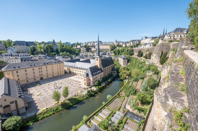
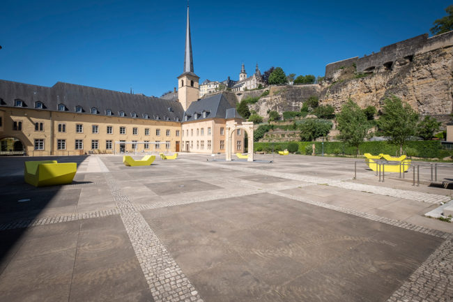
#20 –Neumünster Abbey
After the “Rumm” we go down the street again and through the big archway. Behind the gate on the right side, a spiral staircase goes down and you come out at the old Benedictine Abbey “Neimënster” which is used as a public institution today. We could already see the abbey from above at station 16. Now we come out directly in the large courtyard where festivals often take place as well as concerts and many cultural events. Next to it is the church of St. John. Until 1867, there was a military hospital located in Neumünster, then a men’s prison until 1980 before it was converted into a socio-cultural centre.
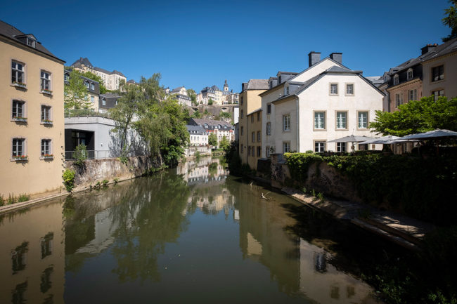
#21 – Gronn
Through the agora, the inner covered courtyard of the abbey, you reach the entrance/exit. Follow the “Rue Münster” always straight ahead. After about three minutes, you will come to the bridge “Stadgronn-Bréck”, also a popular photo motif. Around the bridge there are many hip bars and exquisit restaurants. If you cross the bridge you can take the elevator up to St. Esprit (see station 8) or if you are still fit enough you can walk a detour to the “Péitrus”, our last station.
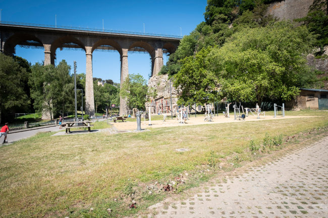
#22 – Péitruss / Petrus Valley
When you have crossed the bridge and turned left, you will come to the end of the “Petrus” valley, which is located just under the Old Bridge (viaduct, passerelle). The “Petrus” is a popular place for outdoor sports. There is a large playground for children and also an outdoor fitness installation, a miniature golf course or a brand-new skater park which is very popular. In addition, you can have a romantic picnic in the “Petrus” valley when the weather is fine, and you will meet many joggers and cyclists.
Sources:
https://lb.wikipedia.org/
https://www.visitluxembourg.com/
Photos: © City Hotel Luxembourg